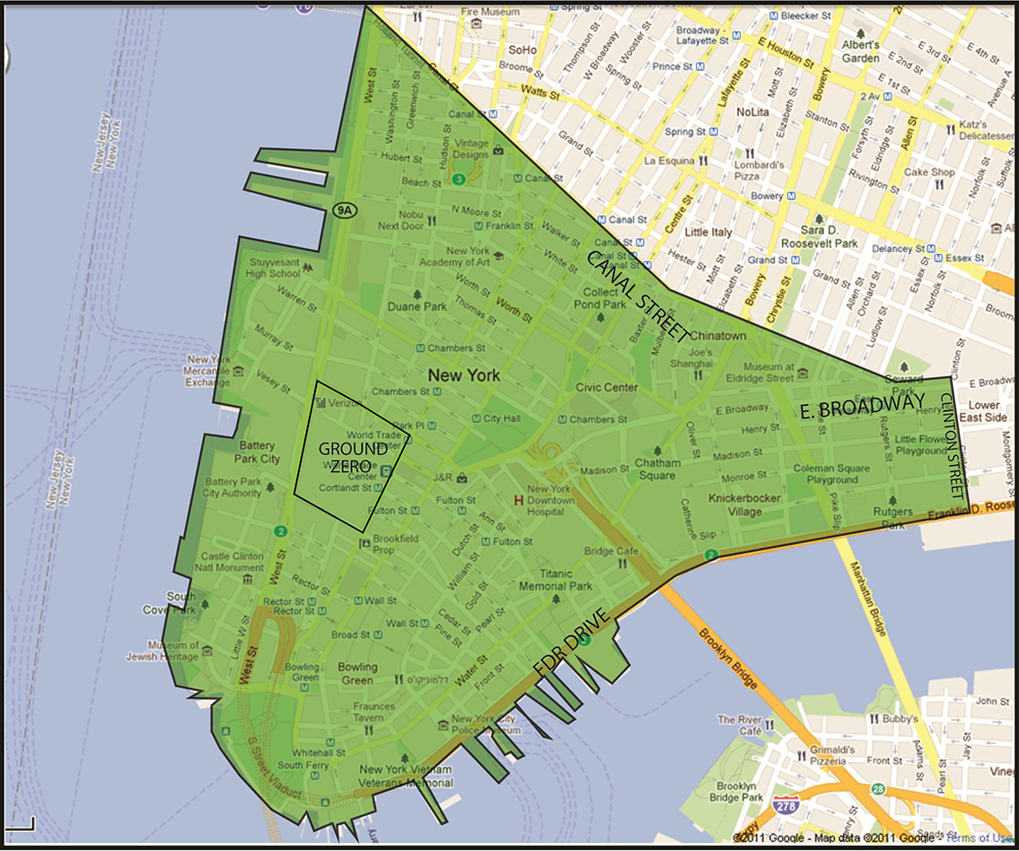
The NYC Exposure Zone is defined as the area in Manhattan south of the line that runs along Canal Street from the Hudson River to the intersection of Canal Street and East Broadway, north on East Broadway to Clinton Street, and east on Clinton Street to the East River; and any area related to or along the routes of debris removal, such as barges and the Fresh Kills landfill. Note: The routes of debris removal apply only to those individuals who loaded, unloaded, or drove the trucks containing WTC debris, worked on the barges transporting the debris, and/or worked at the Fresh Kills landfill.